San Diego River
HABITATS AND CONSERVATION
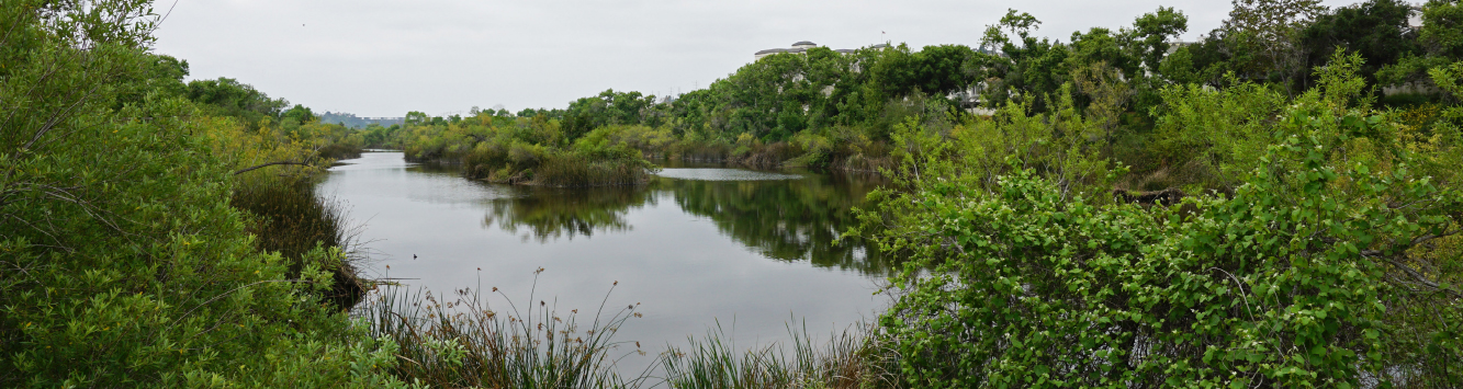
Mission Valley is home to the beautiful San Diego River. With its headwaters in the Cuyamaca Mountains, the San Diego River winds its way west where it flows into the Pacific Ocean. The river crosses through a variety of ecologically significant habitat types and serves as a vital water source for countless flora and fauna critical to our regions’ biodiversity. Several distinct habitats are found along the River and on this site.
Native Plant Communities at SDSU Mission Valley
Diegan Coastal Sage Scrub
This community is the most widespread coastal sage scrub in southern California. The community consists predominantly of low drought-deciduous shrubs such as coastal sagebrush, California buckwheat, white sage, laurel sumac and black sage.
Southern Willow Scrub
This scrub community is typically a dense, broad-leafed, winter-deciduous riparian thicket dominated by several willow species and occasionally scattered with Fremont cottonwood and California sycamore. This community can be found on this site near storm drain outflows.
Southern Cottonwood-Willow Riparian Forest
This forest type generally consists of tall, open, broad-leaved forests that are winter-deciduous. This community is typically dominated by cottonwood, with several tree willows as well as shrubby willows that dominate the understory. Plants in this community require moist, bare mineral soils and are located close to rivers and streams.
Southern Riparian Forest
This forest type is typically dominated by California sycamore and cottonwoods. This community occurs along streams and rivers.
The Day The San Diego River Was Saved!
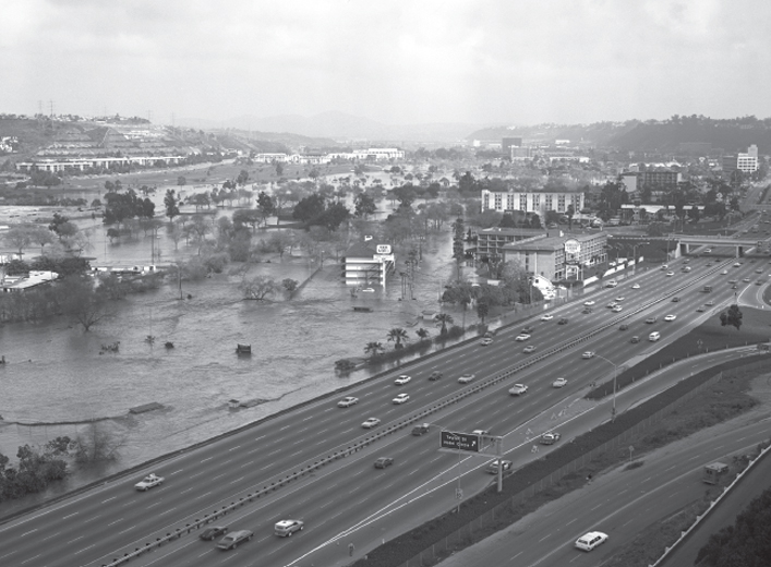
The San Diego River valley is a natural floodplain, which has created challenges for farmers and developers since people first established permanent settlements here. After World War II, Mission Valley transitioned from farmland to a hub for business, housing and hotel development, which increased negative impacts of frequent floods.
In the early 1960’s, the US Army Corps of Engineers drew up flood mitigation plans, which proposed transforming the San Diego River into a concrete channel similar to the Los Angeles River. During the first community meeting to discuss a flood management plan in 1961, the San Diego community resisted the idea of a concrete channel—expressing that it would fragment habitats, destroy riparian zones and prevent groundwater replenishment. Still, the Army Corps continued to refine plans for channelization for a number of years.
A momentous public hearing was held in 1971, during which most of the 1,000 attendees stood in opposition to the concrete channel. As a result, the project was finally re-examined and plans to build the concrete channel were brought to a halt—the San Diego River was saved!
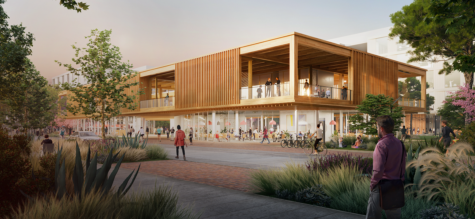
In 1982 the City Council approved the First San Diego River Improvement Project (FSDRIP)—a collaboration between landscape architects, biologists, public agencies and engineers—pronounced: fizz-drip. FSDRIP created a natural-bottom channel with raised walls, elevated flood-prone roads and added new open spaces along the river. FSDRIP, along with other river restoration and protection projects, has reduced and controlled flooding around the river while restoring habitats and creating spaces for humans to enjoy the river.
The history of the San Diego River reveals over 200 years of challenges to its ecological and hydraulic integrity. By reducing impervious areas on this site and adding 80 acres of open space, SDSU Mission Valley continues the legacy of positive improvements along the San Diego River.