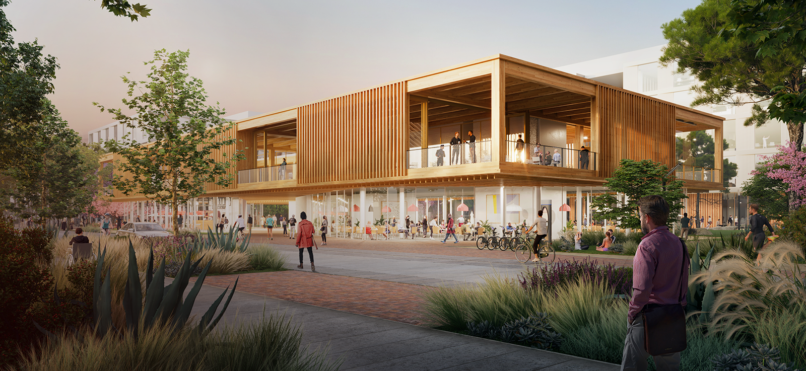
River Park
Report non-emergency, janitorial, landscaping, and security concerns—such as overflowing trash bins, property damage, graffiti, and landscaping issues—using the Urban Strategy Services (USS) app.
Prefer not to download the app? Email service requests to [email protected].Service Requests
Event Permits, Parking, Rules and Regulations
Explore the River Park
for multiuse recreation
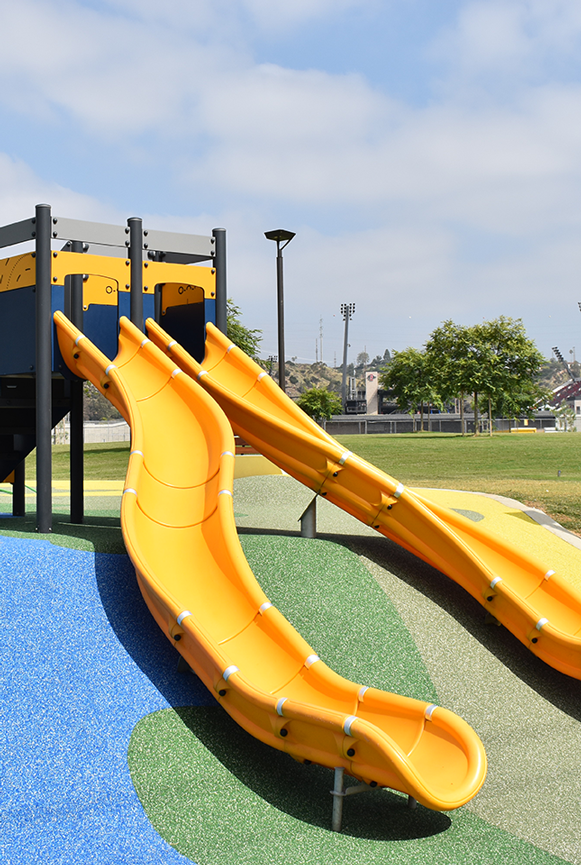
welcome to play on the playground
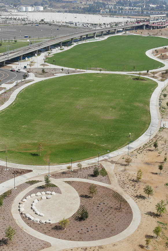
with interpretive signage and Kumeyaay art
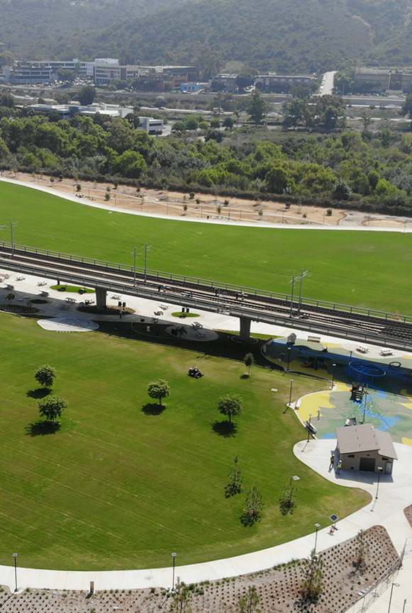
The development of SDSU Mission Valley will provide San Diego with access to approximately 80 acres of community parks and open space, including the expansive 34-acre river park.
Environmental Benefits
- Areas in the Murphy Canyon Creek and San Diego River floodplain are exclusively park and open space, designed to serve as a buffer and occasionally filter flood and stormwater draining to the San Diego River.
- SDSU Mission Valley's grading plan and storm drain system collect and treat runoff, directing drainage to retention basins before it travels to the San Diego River. This is a significant improvement over existing conditions, which allow runoff to travel across the concrete parking lot and directly enter the San Diego River without treatment.
Biodiversity & Native Plants
- In addition to protecting the native vegetation already on-site, SDSU integrates drought-tolerant and native plants prominently into the park design. Below are just a few that are planted across SDSU Mission Valley and Snapdragon Stadium:
- California Poppy, California Sycamore, California Wild Rose, Coastal Agave, Coast Live Oak, Mohave Yucca, San Diego Sunflower, and White Sage.
Active Recreation
- The site includes six multi-use fields, including two adjacent to the new stadium, suitable for soccer, rugby, flag football, and a variety of youth and intramural sports.
- Along the property’s south side beneath the shade of the elevated trolley line, there are picnic areas, fitness equipment, basketball courts, a skate area, and other hard court activities.
- The park includes play structures for kids and a designated area for an off-leash dog park.
Passive Recreation
- An approximately 2-mile pedestrian and bike trail is located throughout the River Park, connecting to the regional San Diego River Trail system.
- A section of the bike and hike trail includes the Ben and Nikki Clay River Trail.
A River Park Design Workshop was held in Dec. 2019. Take a look at the Mission Valley River Park presentation from that workshop to see how community input helped shape the design for our parks and open space.